GeoFly GmbH scores with innovative remote sensing technology
Flying land surveyors from Saxony-Anhalt meet customer requirements all over the world
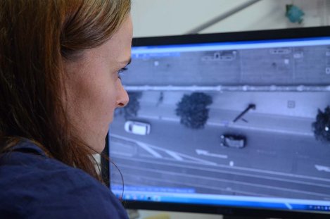
Images of the earth from a bird's eye perspective are not just visually impressive, they also contain lots of information that can only be painstakingly gathered on the ground. One important advantage is that vast areas can be seen at a glance from the air. However, one simple photo from the aircraft cockpit is rarely enough to meet the requirements, for example of research institutes, urban planners or energy providers. Carefully planned aircraft campaigns, state-of-the-art camera and computer technology and the expertise of specialists, geomatics surveyors, are necessary.
At the moment, the team from the company GeoFly, located in Magdeburg, capital of the German federal state of Saxony-Anhalt, is using three aircraft for survey flights: a Cessna 182T and two Aero Commander 680 FLs. The survey data is collected using four digital high performance cameras in total and a laser scanner. Short camera shooting times and high image resolution allow for efficient work in the air. The images in the true colour and infrared range are recorded on redundant storage systems with data volumes of several terabytes and edited by employees at the company's work stations according to customer requirements after landing.
A LIDAR system is used exclusively to record altitude information for terrain models. From the running time of laser impulses that are radiated from the LIDAR instrument in the aircraft to the ground, reflected back from there and measured in the aircraft, GeoFly employees can determine terrain structures with an accuracy of just a few centimetres.
One of the company's specialities is the production of so-called digital orthophotos (DOPs). These are geometrically rectified aerial photos that can be used for surveying purposes and in computer cartography. Georeferenced, i.e. images provided with geographical data, can be produced with resolutions of up to one centimetre.
The many different possible uses for orthophotos include urban and infrastructure planning, ecological, pedological, agricultural, geographical or archaeological investigations and determining coastal changes. The GeoFly technology is also already being used for the planning of new electric power lines.
The production of three-dimensional digital object models, which besides altitude and inclination information also contain shading information, also allow for the recoverable energy potential from photovoltaics or solar thermics on house roofs to be determined, another service offered by GeoFly GmbH in cooperation with the partner company GeoContent GmbH.
The specialists in flight remote sensing also acquire thermal infrared images of above and below ground district heating pipes on behalf of customers to establish the location of any damage with an accuracy of a few centimetres. The sensitive sensors allow for the pipes' surface temperatures to be accurately measured to a tenth of a degree. With these so-called thermal flights heat loss from houses can also be determined exactly and information can be derived from this for thermal insulation.
Through the partner company GeoContent, GeoFly also has access to a Germany-wide aerial image archive and to a global network of aerial image data through AeroGrid.
Numerous international projects have been completed recently. For example, high-resolution aerial image data and surface models were provided for water suppliers on the Philippines. GeoFly employees took part in producing extensive high resolution orthophotos of all the cities in Turkey. And on Iceland the German team of researchers is assisting local scientists with producing up to date hazard maps in relation to volcano eruptions and melting glaciers.
In Germany GeoFly GmbH is one of the first companies to train geomatics surveyors, an occupation that was only created five years ago – they are specialists in the modern surveying of the world.